বাংলা
 English
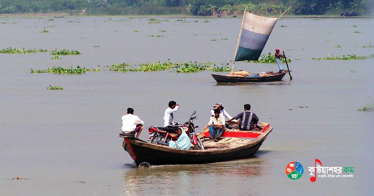
The Gorai-Madhumati river is the main distributary of the Ganges in the Bangladesh portion. The same river is known as the Gorai upstream and the Madhumati downstream. It is 89 km as the Gorai, 137 km as the Madhumati and 146 km as the Baleshwar — a total length of 372 km.
At one time the main stream of the Ganges flowed through the Gorai-Madhumati river, although the Hooghly-Bhagirathi was the original course of the Ganges. Nineteen kilometres downstream of the Hardinge Bridge — to the north of Kushtia district — the Gorai river originates from the Ganges at a place called Talbaria. Flowing through the Kushtia district, the river enters the Jhenaidah district at a place called Ganeshpur. Then, flowing along the Jhenaidah-Kushtia border, it enters the Rajbari district through the village called Chadar. Thereafter, flowing along the borders of the Jhenaidah-Rajbari, Magura-Rajbari and Magura-Faridpur districts, it flows as the Madhumati through the Narail and Bagerhat districts. The Madhumati later flowed as the Baleshwar through the Pirojpur district and, taking the name Harinaghata near the estuary, fell into the Bay of Bengal.
The Gorai is an extremely ancient river. In the past its name was Gauri. The famous astronomer and geographer Ptolemy mentioned five mouths at the confluence of the then Ganges flow with the sea. Some believe that the mouth named 'Kambari Khan' was in fact the Gorai. The course of the Gorai-Madhumati river is long and extensive. Over most of its course the river flows twisting and turning. From the source to Kumarkhali, boats and other small vessels can ply during the monsoon season, but in the dry season this portion becomes unnavigable. The lower portion from Kumarkhali is reasonably navigable, and navigation is possible here almost all year round. The maximum water flow at Kumarkhali is 7,932 cubic metres, but as the source dries up, at times the flow drops to zero. The average width from the source to Borodia is 450 metres. After that the river's width gradually increases and averages 3 km in the lower reaches. The portion of the river from its estuary to Kumarkhali is influenced by the tides. Near Kushtia town, the mouth of the Gorai closes up in winter.
The Gorai river is erosion-prone. Owing to its strong erosion, Kushtia's famous Renwick factory, the Ganges-Kopotakkho Irrigation Project office and the commercial area of Kushtia town face the risk of being swallowed by the riverbed. Besides, Kumarkhali port and Janipur bazar have also been damaged by river erosion. At present the Bangladesh Water Development Board has built some groynes to protect the above-mentioned towns and ports.
Along its course the Gorai-Madhumati has given birth to many distributaries and has come into contact with many other rivers. The Kumar, Kaliganga, Dakua and Buri Gorai are distributary rivers of the Gorai. The Chandana is a tributary of the Gorai. Rivers such as the Nabaganga, Chitra, Kopotakkho, Khulna-Jamuna, Golghasia, Elengkhali and Atharobanki have come into contact with the Gorai-Madhumati river in one way or another.
The Gorai-Madhumati is one of the longest rivers of Bangladesh. Its basin too is vast. As the river flows through districts such as Kushtia, Jessore, Faridpur, Khulna, Barishal and Patuakhali, the irrigation and agriculture of these areas depend to a great extent on this river. Kumarkhali, Janipur, Cheuria, Ganeshpur, Katlagari, Khulumbari, Langalband, Sachilapur, Nakol, Lohagara, Pangsha, Baliakandi, Boalmari, Kashiani, Bhatiapara, Nazirpur, Pirojpur, Sarankhola, Mathbaria, Patharghata and Morelganj are notable places along the banks of the Gorai-Madhumati river.