বাংলা
 English
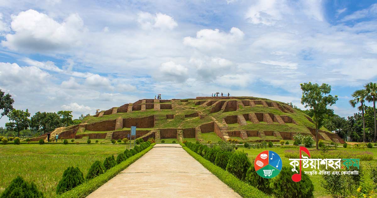
Mahasthangarh is one of the most ancient archaeological treasures of Bangladesh. This famous city was also known in history as Pundravardhana or Pundranagar. At one time Mahasthangarh was the capital of Bengal. Even before the birth of Jesus Christ, that is about two and a half thousand years ago, a civilised settlement flourished here - archaeology itself bears proof of it. In 2016 it was declared the cultural capital of SAARC.
Within this walled city lie archaeological remains of different periods. For several centuries this place was the provincial capital of the mighty Maurya, Gupta, Pala and Sena rulers, and later the capital of the Hindu feudal kings. From the third century BC to the fifteenth century AD, countless Hindu kings and kings of other faiths reigned here. Mahasthangarh is situated in Shibganj upazila of Bogra district. Going about 13 km north of Bogra town, on the western bank of the Karatoya river, the ruins of this city can be seen.
History
The famous Chinese traveller Hiuen Tsang came to Pundranagar between 639 and 645 AD. In his travel account he described the nature and way of life of that time. As the place was famous for Buddhist learning, monks from China and Tibet then used to come to Mahasthangarh to study. Afterwards they set out for the various countries of South and East Asia, and there they spread the teachings of Buddhism.
When Lakhman Sen (1082-1125), the last king of the Sena dynasty, was the king of Gaur, this fort was left unguarded. The king of Mahasthan was Nal, who was locked in conflict with his brother Nil. At that time a cursed Brahmin came here from Srikhetra in the Deccan of India to do penance for his sin. He was cursed for the guilt of killing his mother with a parashu or axe. Later he himself put an end to the conflict between the two brothers and became king. The name of this Brahmin was Ram; in history he is known as Parashuram. According to legend, he was a tyrant.
Dislodging King Parashuram, to establish the peace of Islam there came the dervish of great spiritual power in the guise of a fakir, Hazrat Shah Sultan Balkhi (RA), along with his disciples. Wonderful legends surround the religious preacher Shah Sultan Balkhi (RA). It is said that when he entered Mahasthangarh, that is ancient Pundranagar, he crossed the Karatoya river riding on the back of a boat shaped like a giant fish. On reaching Mahasthangarh he began to preach the call of Islam; at first the commander-in-chief of King Parashuram, his ministers and some ordinary people accepted the message of Islam and became Muslims. As the people of Pundravardhana went on embracing Islam in place of Hinduism, a conflict arose between King Parashuram and Shah Sultan, and in time Sultan Balkhi defeated Parashuram (1205-1220), the last king of Pundravardhana, in battle and conquered Pundravardhana.
Geography
The location of Mahasthangarh, capital of Pundravardhana, is 13 kilometres (6.8 miles) north of Bogra town, beside the Bogra-Rangpur highway. It is believed that the main reason for founding the city here is that it is one of the highest areas of Bangladesh. The land here is 36 metres (118 feet) above sea level, whereas Dhaka, the capital of Bangladesh, is only 6 metres (20 feet) high. Another reason for choosing this site was the location and shape of the Karatoya river. In the thirteenth century the river was three times wider than the present Ganges. Mahasthangarh stands on the red soil of the Barind tract, which is somewhat higher than the silt-built plains. The areas lying 15-20 metres higher may be regarded as flood-free geomorphic zones.
Discovery
Several persons contributed to identifying and unearthing the ruins of Mahasthangarh. In 1808 Francis Buchanan Hamilton first located Mahasthangarh. In 1879 the British archaeologist Alexander Cunningham first identified this ancient historic city as the capital of Pundravardhana. Many travellers and scholars, notably C. J. O'Donnell, E. V. Westmacott and Henry Beveridge, visited this suburban area and mentioned it in their reports. In 1931 archaeological excavation unearthed a Brahmi inscription. In that inscription the provincial governor of Pundranagar, Emperor Ashoka, ordered that food grain and money from the royal treasury be given as aid to the famine-stricken people. From all this information the earliest evidence of this famous city is found.
Fortification
The fort at the centre of the ancient city was, seen from above, oblong in shape, extending 1.523 kilometres (0.946 miles) north-south and 1.371 kilometres (0.852 miles) east-west. On each of its sides there was a high and broad rampart of protection. The area of the fort is about 185 hectares. The once wide river Karatoya used to flow on its eastern side. Before the excavations, until 1920, the fort stood 4 metres higher than the surrounding area and was marked by quite a few high earthen layers. The rampart looks like a wall of mud-clay, and at many places it shows signs of forceful breaking. The rampart is 11-13 metres (36-43 feet) higher than the surrounding area. At its south-eastern corner there was a mazar. Besides, there is a mosque built at a later date (1718-19). At present several mounds and building remains can be seen inside the fort. Notable among them are Jiyat Kunda (a well believed to have the power of giving life), Mankalir Dhap (the sacred place of Mankali), Parashuramer Basghar (the palace of King Parashuram), Bairagir Bhita (the hermitage of female ascetics), Khodar Pathar Bhita (a stone dedicated to God), Munir Ghon (a small pit) and so on. There are several gateways at different places, such as Kanta Duar (to the north), Dorab Shah Toran (to the east), Burir Fatak (to the south) and Tamra Darja (to the west). At the north-eastern corner there are a few steps (joined later) leading down to Jahajghata. A little ahead of Jahajghata, on the bank of the Karatoya river, stands Govinda Bhita (the temple of Govinda). In front of it is the local museum where some notable relics are displayed. Beside it there is a rest house.
Infrastructure of the City
Besides the fort structure, about half a hundred mounds are scattered over a wide area of 9 km radius.
Excavated mounds:
- Govinda Bhita, a temple situated at the north-eastern corner of the fort
- Khullanar Dhap, a temple
- Mangalkot, a temple situated 1.6 km south or south-west of the Mahasthangarh museum
- Gadaibari Dhap, a temple 1 km south of Khullanar Dhap
- Totaram Panditer Dhap, a hermitage situated 4 km north-west of the fort
- Norpatir Dhap (Vasu Bihar), a cluster of hermitages 1 km north-west of Totaram Panditer Dhap
- Gokul Medh (Lakhindarer Basor Ghar), a temple 3 km south of the fort
- Skander Dhap, a temple 2 km south-east of Gokul Medh
- Bairagir Bhita, where the ruins of two temples were found when excavated in 1928-29
Principal unexcavated mounds:
- Shiladebir Ghat
- Chunoru Dighi Dhap
- Kaibilki Dhap
- Jurainatala
- Parashuramer Shobhabati
- Bolai Dhap
- Prachir Dhibi
- Kanjir Hari Dhap
- Lahanar Dhap
- Khojar Dhibi
- Dolmoncho Dhibi
- Dhaniker Dhap
- Mandirir Dargah
- Bishmordan Dhibi
- Molinar Dhap
- Molpukuria Dhap
- Yogir Dhap
- Padmabatir Dhap
- Kanai Dhap
- Dulu Mazhir Bhita
- Padmar Bari
- Ojha Dhanvantarir Bhita
- Rastala Dhap
- Shashitala Dhap
- Chander Dhap
- Sindhinath Dhap
- Dhibi of the kachari bari of King Shalibahan
- Dhanbhandar Dhibi
- Kancher Angina
- Mongalnather Dhap
- Choto Tengra / Babur Dhap / Kedar Dhap
- Sannyasir Dhap
- Doshahatina Dhap
Excavations
The formal archaeological excavation of Mahasthangarh was first started in 1928-29 under the supervision of K. N. Dikshit of the Archaeological Survey of India. At that time Munir Ghon and Bairagir Bhita around Jahajghata were examined. Excavation work at Bairagir Bhita and Govinda Bhita was suspended in 1934-36. In 1931 archaeological excavation unearthed a Brahmi inscription. In that inscription the provincial governor of Pundranagar, Emperor Ashoka, ordered that food grain and money from the royal treasury be given as aid to the famine-stricken people. In 1960 excavation was carried out at the mazar, Parashuram's palace, Mankalir Dhap, Jiyat Kunda and near the rampart on the northern side. Later-stage excavation on the eastern and northern ramparts was carried out intermittently, although the final report has not yet been published.
The preliminary reports of these excavations were published in 1975. Almost two decades later, in 1988, excavation was resumed and continued almost every year until 1991. During this period the excavation was confined to the area near the mazar and the parts adjoining the ramparts on the north and east. But the volume of work completed at this stage was very small compared to the vastness of the area. The history and cultural sequence of the site are still unknown. The need to conduct a comprehensive survey to reconstruct the ancient history of the site and the region and to learn about the organisation of the ancient city had long been felt. Accordingly, under the agreement signed between Bangladesh and France (1992), Bangladeshi and French archaeologists undertook a joint initiative in early 1993. Since then annual archaeological excavation has been carried out at the place adjoining the middle part of the eastern rampart. Earlier, excavation was also conducted by the Department of Archaeology of Bangladesh at several sites outside the fortified city, such as Vasubihar, Bihar Dhap, Mangalkot and Gadaibari. During the excavation of the city, at several places digging was carried down to the virgin soil of the site. Among these, the recent excavation conducted by the France-Bangladesh Mission has uncovered 18 building phases. From 1929 to date (including the France-Bangladesh initiative), the excavations carried out at various times have revealed the following cultural sequence.
First period: This phase contains, as memorials of pre-Maurya culture, a large quantity of Northern Black Polished Ware of the NBPW phase, rouletted ware, black and red ware, black-slipped ware, grey ware, stone querns, mud houses with clay floors (kitchen), hearths and postholes. Northern Black Polished Ware was found in the largest quantity at the lowest level. Among them dishes, cups, glasses and bowls are the main ones. At this level, in a very limited area, a brick-laid floor was found. But no wall connected with the floor has been found yet. Probably the first settlement here was established on Pleistocene land. A radiocarbon date of the upper settlement level has been obtained for the later part of the fourth century BC. From this it may be presumed that the settlement of this level belongs to the pre-Maurya age. It needs to be determined whether this earliest settlement level is related to the Nanda or near-historical culture.
Second period: The antiquities found of this age include broken tiles (known to be the earliest evidence of tiles used for such roofing), brick bats used for mixing or bonding in the construction of mud walls (occasionally also for domestic purposes, such as the hearth, a terracotta ring-well), Northern Black Polished Ware, dull red or dull yellow plain pottery, ring stones, bronze mirrors, bronze lamps, cast coins, terracotta plaques, terracotta animals, beads of semi-precious stones and stone querns. Several radiocarbon dates (366-162 BC, 371-173 BC) and the cultural objects place this phase in the Maurya period.
Third period: This period belongs to the post-Maurya (Sunga-Kushan) phase. In this age were found considerable well-preserved brick architectural ruins over a large area, brick-laid floors, postholes, terracotta ring-wells, plenty of terracotta plaques bearing Sunga features, beads of semi-precious stones (agate, carnelian, quartz), surma sticks, punch-marked silver coins, silver bangles, cast copper coins, terracotta temple finials, plenty of dull red or yellow plain pottery (especially dishes, cups, bowls) and grey pottery. Coarse Northern Black Polished Ware is less at this level than in the Maurya level. Some radiocarbon date ranges of the level are 197-47 BC, 60 BC-172 AD and 40 BC-122 AD.
Fourth period: At this time the remains of the Kushan-Gupta age were unearthed. A fair quantity of Kushan pottery shards and plenty of terracotta plaques marked with the definite artistic features of the time are the antiquities discovered of this period. The main pottery types are cooking pots with handles and engraved designs, plates, bowls, spouted vessels and lids. Architectural ruins are fewer in this part than in the upper and lower levels. Broken brick bats stand as evidence of architecture. Other cultural objects are terracotta beads, bowls, stone and glass beads, glass bangles and terracotta sealings.
Fifth period: This period bears the identity of the Gupta and post-Gupta age. Radiocarbon dating has indicated dates ranging from 361 to 594 AD. At this phase, close to the fortified city, were found the ruins of the massive brick structure of the temple known as Govinda Bhita of the late Gupta period, and within the city the ruins of brick-built houses, floors and roads. Besides these there are characteristic-style terracotta plaques, sealings, glass and semi-precious stone beads, terracotta balls and discs, copper and iron objects and a large number of antiquities including vessels decorated with stamped designs.
Sixth period: This period, marked by several scattered archaeological ruins on the eastern side of the city such as Khodar Pathar Bhita, Mankalir Kund Dhap, Parashuram's palace and Bairagir Bhita, bears the identity of the Pala age. This was the richest phase, and in this age numerous Buddhist edifices were built outside the city. Seventh period: the ruins of a fifteen-domed mosque built over the ruins of the previous period at Mankalir Kund, the ruins of a single-domed mosque built by Farrukhsiyar, and other antiquities such as Chinese celadon and glazed pottery characteristic of the age bear the identity of the Muslim period. From the sites within the city - Bairagir Bhita, Khodar Pathar Bhita, Mankalir Dhibi, Parashuram's palace mound and Jiyat Kunda - important archaeological relics have been discovered. Besides these sites, excavation in 1988-91 uncovered the three gateways of the city, a considerable portion of the ramparts on the north and east, and a temple structure near the mazar area.
Two of the three gateways of the Mahasthan site are on the rampart on the northern side. A gateway situated 442 metres east of the north-western corner of the fort is 5 metres wide and 5.8 metres long. The other lies 6.5 metres to the east and is 1.6 metres wide. The two gateways were used in the early period and in the two later Pala phases. The only gateway on the eastern rampart lies almost at its middle and about 5 metres east of Parashuram's palace, and is about 5 metres wide. It is believed that this gateway was built over the ruins of an older gateway towards the end of the Pala period. This gateway has not yet been fully recovered. All the gateway structures have guard rooms on the inner side and bastions extended beyond the rampart.
No coherent building plan can be seen in the temple structure unearthed in the mazar area. It appears to have been built and rebuilt in five phases during the Pala period. The antiquities recovered from this area include several large terracotta plaques, toys and balls, and decorated bricks and clay pots.
The city's rampart was built in six phases. The earliest phase probably belongs to the Maurya period, and the later phases are associated with the Sunga-Kushan, Gupta, early Pala, late Pala and Sultanate periods. These ramparts were built one over another in succession. Thus, along with the successive cultural ruins inside the city, successive construction phases are also observed in the defence wall. However, the mutual relationship between the city's cultural ruins at the earliest level and the earliest rampart is still a matter of investigation.
Govinda Bhita, Lakhindarer Medh, Vasubihar, Bihar Dhap, Mangalkot and Gadaibari Dhap are the excavated archaeological areas in the vicinity outside the city. But many more mounds lie scattered in the neighbouring villages, where the cultural ruins of the outskirts of ancient fortified Pundranagar are believed to lie buried.
Places of Interest
Mahasthangarh is one of the ancient tourist centres of Bangladesh. There are many places of interest here. In 2016, as the cultural capital of South Asia, various events were held at Mahasthangarh.
Information for visitors: Mahasthangarh is situated 13 km north of Bogra, beside the Bogra-Dhaka highway. Beside it flows a feeble stream of the Karatoya river. The road extends up to Jahajghata and the museum. Direct buses are available from Dhaka, and crossing the Bangabandhu Jamuna Bridge over the Jamuna river takes about four and a half hours. Buses are also available from Bogra, and there are rickshaws for local movement. Hired cars can also be had from Dhaka or Bogra. Travelling by hired car, one can return the same way; or, if one wishes, one may go from there to visit the Somapura Mahavihara at Paharpur in Naogaon.
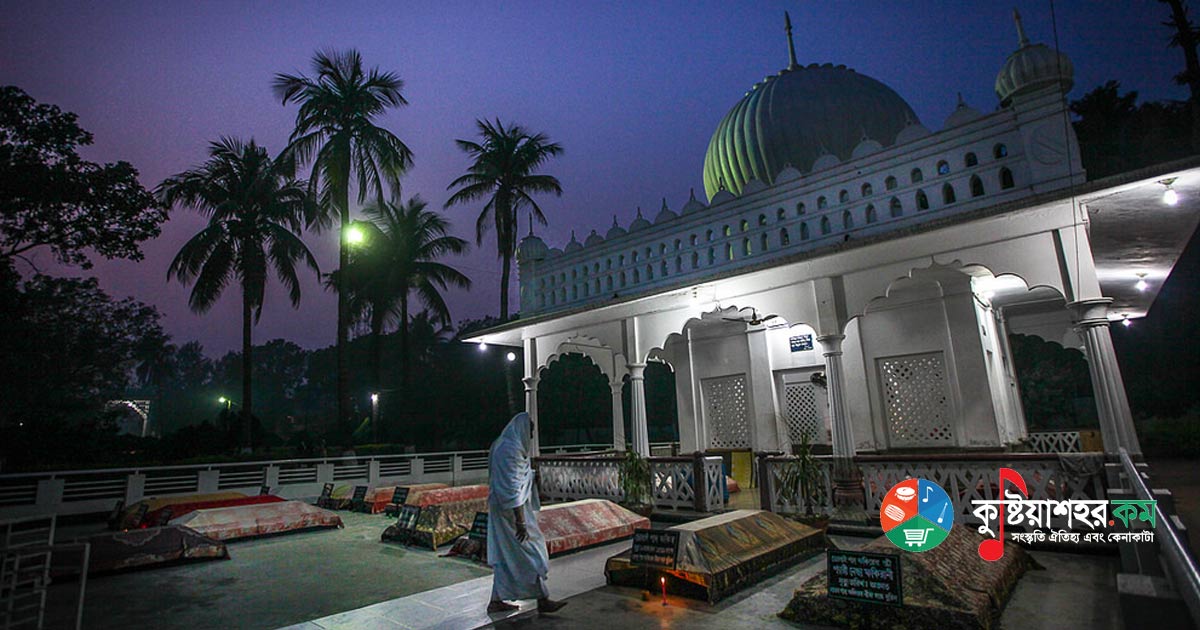
Mazar Sharif: According to many historians and local people, this is the mazar of Hazrat Shah Sultan Balkhi (RA). This mazar sharif is situated a little west of the Mahasthan bus stand. Shah Sultan Balkhi (RA) was a preacher of Islam of the fourteenth century. It is said that in a fish-shaped boat he came with his disciples to the Barind land; from there came his name Mahisawar (one who came riding on the back of a fish). And as he was the son of the king of the realm of Balkh, he is also called Shah Sultan Balkhi. In 1680 Emperor Aurangzeb entrusted the responsibility of looking after this mazar as zamindar to Syed Reza, Syed Tahir and Syed Abdur Rahman (three brothers). The local people hold Shah Sultan Mahisawar in great respect. Thousands of devout Muslims come to this mazar to vow and to seek solutions to their various problems.
Museum: This museum, situated 7 km north of Bogra and a little north of Mahasthangarh, exactly opposite Govinda Bhita, was established in 1967. In the beginning the main part of the museum stood on 3 acres of land, but after expansions at various times its present extent has grown to about 10 acres. The excavation of Mahasthangarh has yielded thousands-of-years-old numerous relics of the Maurya, Gupta, Pala, Sena and other dynasties - various precious metals including gold, silver, iron, bronze and brass, terracotta images, images of black stone and sandstone, carved clay bricks, gold objects, various inscriptions, sharp weapons of self-defence, articles of daily use and various kinds of ancient ornaments and the like - which are preserved in the museum north of the fort. Archaeological relics of various other places besides Mahasthangarh are also preserved here.
Khodar Pathar Bhita: Khodar Pathar Bhita lies on a mound east of the mazar. This oblong Buddhist temple was east-facing. It is a long, square-shaped slab of stone which is not usually found in nature. It is believed that King Parashuram collected it, smoothed it and used it in the work of offering sacrifices. Hindu women used to bathe this stone with milk and vermilion. Even now some people pour milk on this slab barefoot as an offering of devotion. The ruins of this bhita are known to belong to the early part of the Pala period (about the eighth century AD). Excavation at this mound or bhita in 1970 revealed a temple along with some minor archaeological remains. On the surface of this mound a massive granite slab was found, and from this the local people gave the mound such a strange name. Among the carved stone pieces found in the excavation here, three Buddhist images seated in the same row were found, which are now preserved in the Varendra Research Museum. The ruins of the structure of this site still lie buried under the ground; only the massive slab can be seen here.
Mankalir Dhibi: This temple was built by the Ajivika religious preacher Mokshali Gosal. It is situated on the eastern bank of the Moja Pukur of Mahasthangarh. In 1965-66 excavation started here under the supervision of the Department of Archaeology, and eventually quite a few small archaeological objects were discovered along with the ruins of a mosque of the Sultanate period. The mosque measures 26.21 by 14.54 metres. While the excavation was going on, some ruins of a temple were also found beneath the mosque. No inscription was found in the mosque, but judging by the mosque's infrastructure archaeologists believe it was most probably built before the Mughal period. According to legend, King Mansingh and his brother Tansingh first built a temple at this place. According to other legends, the mosque here was built by the zamindars of Ghoraghat. Besides, seeing the Jain image found here, many believe the place was formerly the abode of Jain religious gurus.
Bairagir Bhita: Situated at the north-eastern corner of Mahasthangarh, about 200 yards from King Parashuram's house. This mound measures 300 x 250 feet.
Skander Dhap: It is the ruin of a temple. This dhap lies about 3 km south of Mahasthangarh, about 50 metres east of the metalled road, beside a water body. It is known from the Rajatarangini, a book written in the seventh century AD by a scholar named Kalhana, that there was a temple of Kartik at Pundranagar. It is believed that this temple at Skander Dhap is that temple of Kartik. Excavation has caused much damage to the mound.
Mangalkot Stupa: Situated 1 km west of Mahasthangarh.
Gokul Medh: Situated 2 km from Mahasthangarh in the south-western corner.
Tengra Buddhist Stupa: This stupa, about 45 feet high, is situated at a place called Tengra.
Bihar Dhap: Situated 6 km north-west of Mahasthangarh. The stupa measures 700 x 600 feet.
Vasu Bihar: Situated 7 km north-west of Mahasthangarh and 2 km north of the Buddhist vihara.
Bhimer Jangal: This Bhimer jungle is surrounded on three sides by Mahasthangarh and is rich in countless time-transcending historic structures.
Kalidah Sagor: On the western part of the fort lies the historic Kalidah Sagor and the residence of Padmavati. Adjacent to Kalidah Sagor there is a historic earthen fort named Joripa. In this ancient Kalidah Sagor the Baruni bath of the followers of the Hindu religion is held every year in the month of March. After the bath, the devotees arrange Ganga worship and kirtan ceremonies on the bank of the Sagor.
Shiladebir Ghat: On the eastern side of the fort lies the Karatoya river, and on its bank is 'Shiladebir Ghat'. Shiladevi was Parashuram's sister. Every year the Hindus bathe here and a one-day fair is held.
Jiyat Kunda: To the west of this ghat there is a large well called Jiyat Kunda, one of the archaeological relics of Bangladesh. It is said that Parashuram's wounded soldiers recovered by drinking the water of this well, although no historical basis for it has been found.
Behular Basor Ghar: About 2 km south-west of the Mahasthangarh bus stand there is a Buddhist pillar which is believed to have been built by Emperor Ashoka. The height of the pillar is about 45 feet. In the eastern half of the pillar there is a bathing place resembling a twenty-four-cornered tank. It is better known by the name Behular Basor Ghar.
Govinda Bhita: Govinda Bhita is situated right in front of the Mahasthangarh museum. The word Govinda Bhita means the abode of Govinda (the Hindu deity), that is Vishnu. This bhita is an excavated site; excavated in 1928-29, Govinda Bhita lies to the north outside the fort-palace area. But no relic of Vaishnavism has been found at this place. Still, the site is locally known as Govinda Bhita.
Parashuram's Palace: Parashuram's palace is one of the relics of ancient civilisation discovered within the boundary wall enclosure of historic Mahasthangarh. Locally it is known as the Palace of the so-called Hindu king Pashuram.
Buddhist Viharas:
- Somapura Bihar
- Halud Bihar
- Vasu Bihar
- Ananda Bihar
- Sitakot Bihar
How to Go from Kushtia:
BRTC and various other transports go from Kushtia to Bogra. The distance from Kushtia to Bogra is 224 kilometres. Buses are available from Mojompur and the bus terminal. From Bogra town, Mahasthangarh can be reached by CNG, tempo or rickshaw.
Where to Stay:
Bogra has quite a few hotels and motels. Notable among them are Hotel Naz Garden, Parjatan Motel, Safeway Motel, Northway Motel, Century Motel, Motel Castle MH, Hotel Akbaria. You will even find a four-star hotel here.
Among the good-quality places to stay in Bogra are:
- Hotel Naz Garden: Salimpur, Bogra-5800, Phone: 88-051-62468, 66655, 63272, 64197, 78088
- Parjatan Motel: Banani Mor, Bogra, Phone: 051-66753
- Akbaria Hotel: Kazi Nazrul Islam Road, Thanaroad, Bogra, Phone: 01716-179982
- Motel Northway, Sherpur Road
- Hotel Al Amin, Nawabbari Road
- Hotel Royal Palace, Uposhohor
- Hotel Sun View, Sherpur Road
- Hotel Safeway, Shantahar Mor
- Hotel Rajmoni, Bogra Raja Bazar
- Hotel Honey Day, Boro Mosque Lane
- Hotel Aziz, Kabi Nazrul Islam Road