বাংলা
 English
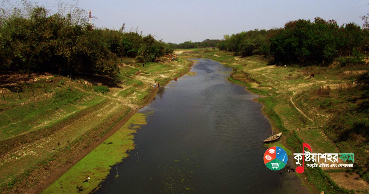
The Mathabhanga is a transboundary river of Bangladesh and India. It flows through the Kushtia, Meherpur and Chuadanga districts of Bangladesh. The Mathabhanga, the second largest branch of the Padma, is the principal river of Chuadanga district. From its birth the Mathabhanga was the Padma's main branch. About 400 years ago, when the Ganges still flowed down the Bhagirathi and the riverbed there silted up and filled, the Mathabhanga carried away the main current.
In 1870, Dr. Thomas Oldham noted in the proceedings of the Asiatic Society that the area between the Bhagirathi and the Bhairab was gradually filled with river-borne silt. As a result, when the flow slowed further, the Padma shifted eastwards and the Mathabhanga came into being. According, however, to the famous irrigation expert William Willcocks, the Mathabhanga is nothing but a canal cut for irrigation.
Among the three principal rivers of undivided Nadia district, the Mathabhanga was the chief. The Mathabhanga is known as the river of Nadia. At one time this river was very swift. It is said that it swallowed many settlements and broke people's heads, and so it was named Mathabhanga. Another view is that the name was given because its connection with the parent Padma at the upstream end was broken — that is, its 'head' or mouth was broken. At one time, however, this river was known as Haulia or Hauli. Before the railway was introduced in 1862, this region's communication with Calcutta was by way of the Mathabhanga waterway.
The Mathabhanga flows through the heart of Damurhuda upazila and enters Nadia district at the southern border. In 1771 the East India Company appointed Mr. Rennell to river survey work. Rennell's map was published in 1780. It notes that large boats had difficulty navigating the Mathabhanga in summer. After the survey of the Mathabhanga River was completed in 1795, it was improved and made fit for river-borne trade.
In 1797 the Mathabhanga's depth decreased due to the decay of its silt. In 1813 the government levied a tax for the improvement of the Mathabhanga. In 1819–20, G. K. Robinson was appointed the Mathabhanga's chief supervisor and collector. On the other hand, the Mathabhanga's own branch river, the Kumar, emerged as its peril. As four-fifths of the Mathabhanga's current flowed away through the Kumar, the river's decline was hastened.
In 1823, for the first time in Bengal, an ox-driven dredging machine was brought in at a cost of 10,400 pounds. But that very year the Mathabhanga's course suddenly changed. Later, in 1881, the Mathabhanga suddenly became navigable again. It became clear that the region's rivers depended on the currents of the new Ganges and the Padma. At present the Mathabhanga announces its existence in the form of a large canal. Yet as recently as 1971, the Mathabhanga's maximum recorded water flow at the Darshana point of the upazila was 12,900 cusecs.
The river is 121 kilometres long, 29 metres wide, with a depth of 10 metres near Darshana. The river basin covers an area of 500 square kilometres. Usually the river does not overflow its banks and flood the surrounding areas. The river is free from tidal influence. The identification number assigned to the Mathabhanga River by the Bangladesh Water Development Board, or "Paubo," is River No. 76 of the South-Western Region.
The Mathabhanga originates from the Padma about 16 kilometres east-southeast of the source of the Jalangi in Murshidabad district.
Flowing from its source past the Kushtia and Meherpur districts up to Hauli union of Damurhuda upazila in Chuadanga district, the Mathabhanga finally falls into the Ichamati–Kalindi river.